I wasn't able to get out for a hike last weekend because I spent the whole time cooped up inside preparing for my masters thesis defense on Monday. I passed (woohoo!) and have successfully earned my masters degree in environmental engineering which is super exciting but it's also pretty bittersweet because it means that my time in Arizona is coming to a close. While I will continue to explore around the Great Lakes, I will definitely miss all of the cool things I've gotten to do in my time out west. However, in the mean time I am going to try to revisit as many of my favorite trails as I can out here.
Wednesday afternoon I took the path less traveled at the Tom's Thumb Trailhead, the Marcus Landslide Trail, part of the McDowell Sonoran Preserve in Scottsdale. The Marcus Landslide Trail is a 3 mile out and back that takes you along the eastern face of the McDowell Mountains to the Marcus Landslide, the second largest landslide in Arizona. The trail also features a cool little 0.7 mile loop through the field of boulders that fell off the top of the mountains. The trail is much less crowded than Tom's Thumb and much less strenuous, gaining only 300 ft. of elevation. However, the views are absolutely spectacular, providing a panorama of Four Peaks, the Tonto National Forest, the Superstitions, and Weaver's Needle. The trail also features several interpretive pull-offs that provide signage to inform you about the geology of the region.
The first section of the trail involves traveling from the trailhead around the northern tip of the McDowell Mountains. This section takes you through some open desert passing stands of Palo Verde, Chainfruit Cholla, and Prickly Pear. Along the way there are also several access points for rock climbers to reach bolted routes, which date back to the 1970s and 1980s before the preserve was established.
 |
| Heading east along the Marcus Landslide Trail |
 |
| The Trail also provides access to many bolted climbing routes in the McDowells |
Once you reach the east side of the mountain range, the panoramic views open up. The flat valley makes for excellent visibility of the Superstitions and Weaver's Needle some 40 miles away.
 |
| Weaver's Needle and the Superstitions |
 |
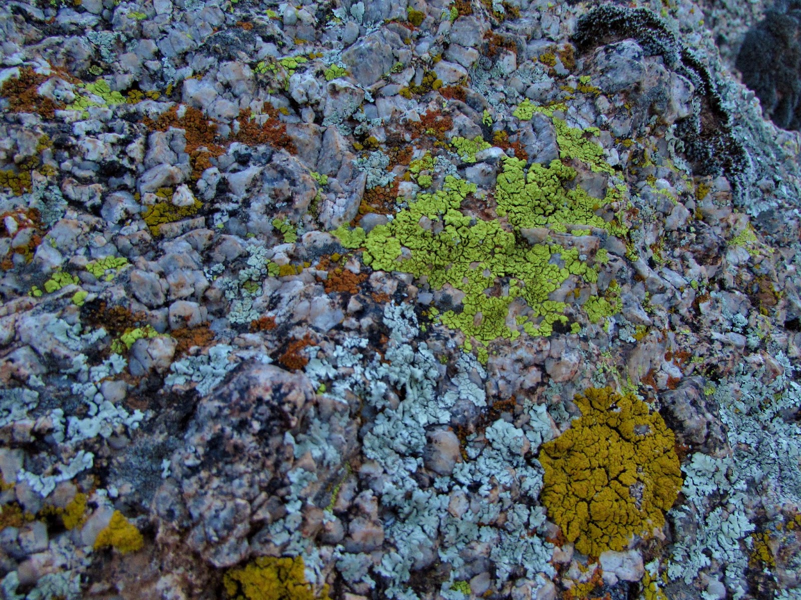
| Many of the boulders are covered by lichens, small symbiotic organisms composed of algae and fungi |
 |
| Giant Saguaro |
After about a mile of hiking you begin to be surrounded by boulders from the landslide. The Marcus Landslide is named after Dr. Melvin Marcus, a late
geography professor at Arizona State University. Discovered in 2002 by
two graduate students at ASU, the landslide occurred approximately
500,000 years ago. 194 million cubic feet of rock and soil fell from the
top of the McDowell Mountains, releasing the energy of an atomic bomb
and spewing debris across a 4,000 ft. long and 1,600 ft. wide field.
 |
| Approaching the Marcus Landslide |
 |
| "The fallen mushroom" - this boulder gets its shape from erosion |
 |
| An in tact "Mushroom" boulder |
 |
| Looking north from the loop through the Marcus Landslide |
 |
| The Marcus Landslide |
 |
| The Marcus Landslide |
 |
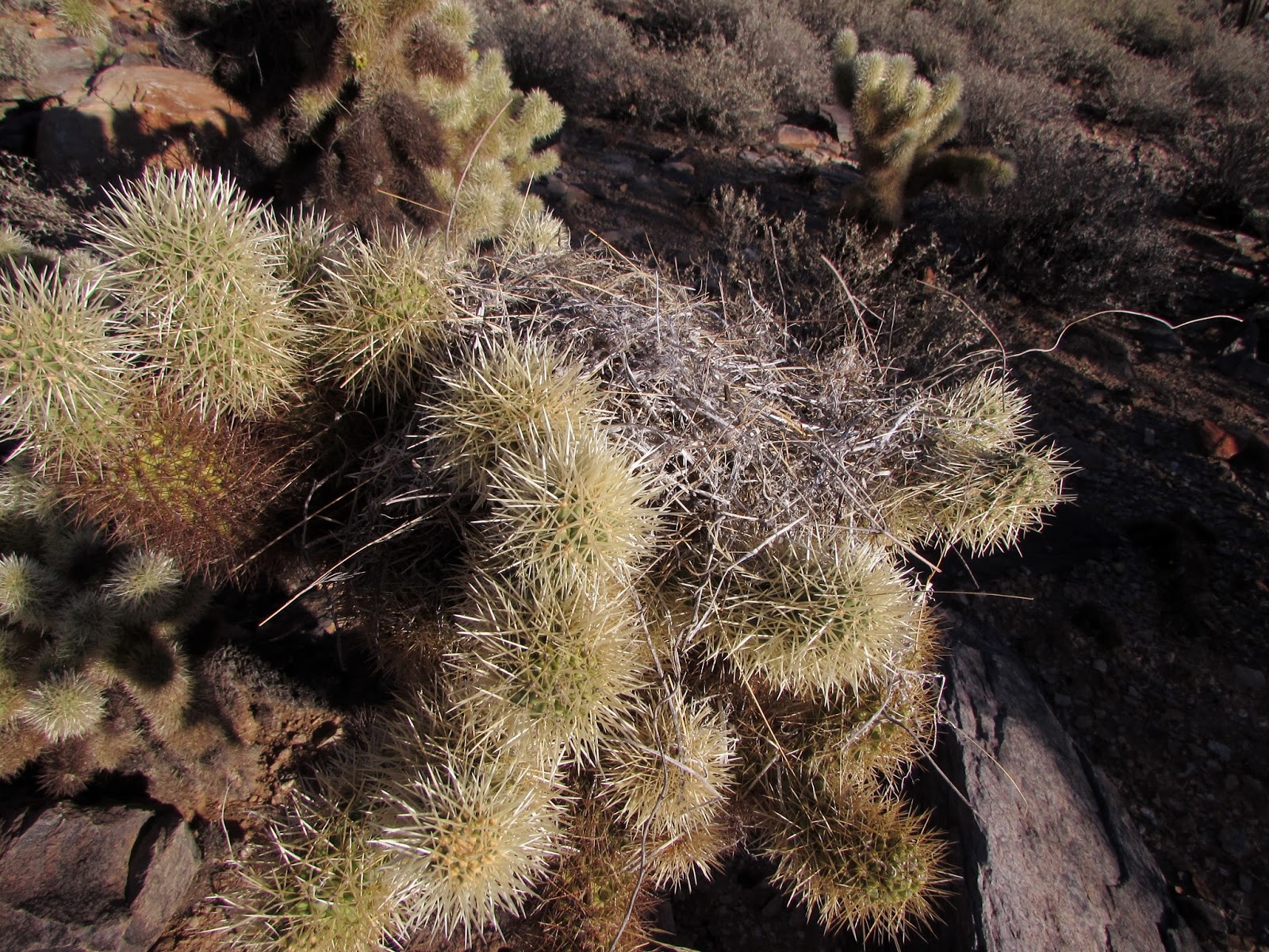
| Teddy Bear Cholla |
 |
| The dried out fibers of a dead Teddy Bear Cholla |
 |
| Heading back to the car at sunset |
The
trail also provides great opportunities to view wildlife, especially at
less crowded times such as a weekday afternoon. I saw several Coyotes,
Desert Cottontail, and several species of birds including Gambel's Quail
and Greater Roadrunner.
 |
| Coyote |
 |
| Coyote |
 |
| Desert Cottontail |
 |
| A Coyote crossing over the border of the McDowell Sonoran Preserve |
The sunset was a really cool time to explore the trail because of how beautiful the surrounding mountains looked illuminated by the setting sun.
 |
| Four Peaks at sunset from the trail |
 |
| Four Peaks at sunset from the trail |
The Trail:
Marcus Landslide Trail, 3.7 miles, 300 ft. elevation gain
For more info check out the McDowell Sonoran Conservancy:
http://www.mcdowellsonoran.org/trailhead/displayHike/10#sthash.AU5AYnT6.dpbs
Leave No Trace!