|
| Bonito Park, Flagstaff |
This weekend I finally got to return up to Flagstaff after nearly 2 months of being unable to schedule a trip up to the high country. With temperatures in Phoenix hovering around 110 this weekend we headed for higher ground and cooler temperatures. Sitting at an elevation of 7000 ft. Flagstaff is a top destination for people looking to get out of the summer heat of the valley. We were also looking forward to spending some time in the greenery of the forest. We were heading up to hike the Kendrick Trail to the lookout tower at the summit of Kendrick Peak. At 10,418 ft. it sits just outside the top 10 highest peaks in Arizona but provides excellent views of the Kachina Peaks to the northeast. The rims of the Grand Canyon are visible to the north on a clear day as are the mountains surrounding Prescott to the south. Located within the 6,510 acre Kendrick Mountain Wilderness Area and spanning the border of the Coconino and Kaibab National Forests, the trails to the summit of Kendrick Peak provide much more solitude than the routes to the top of Mt. Humphreys (Arizona's highest point). There are three routes to the top of Kendrick Peak: the Kendrick Trail, the Pumpkin Trail, and the Bull Basin Trail, each around 9 miles in length. We decided on the Kendrick Trail for no particular reason. It was also a special trip because this would be our last hike with one of our friends from ASU as he would be returning to France in a few days. Although we are so sad to see him leave, we were so lucky to have him in our lab and I can't wait to visit him someday and get out for a hike in Europe with my Daft Punk loving friend.
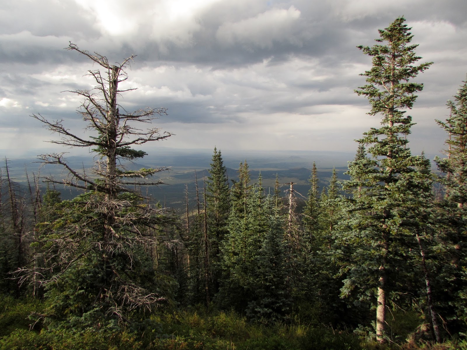
We began our hike around 2 PM. At 9.2 miles in round trip length with 2,600 of elevation gain the trail was challenging but incredibly scenic. The trail begins by hiking through pine forest into a large meadow of common mullein, lupines, and charred trees. A 15,000 acre forest fire broke out in 2000, resulting in significant loss of vegetation within the Kendrick Mountain Wilderness. The meadow was also very interesting because as we walked along the trail we were surrounded by dozens of cows, which are grazed in the area as a means of vegetation control. After only a quarter mile of hiking we began to hear thunder in the distance. Although we saw storm clouds brewing on the horizon, the forecast had called for only a 10% chance of showers and with no lightning visible we decided we would continue on the trail as long as we could.
 |
| Kendrick Trail through a meadow of Common Mullein |
 |
| Hoary Aster along Kendrick Trail |
 |
| A view of Kachina Peaks from the Kendrick Trail |
 |
| Hummingbird along Kendrick Trail |
 |
| Indian Paintbrush |
 |
| Ferns covered much of the trail |
 |
| As the trail climbed, groves of Quaking Aspen provided beautiful scenery |
The trail climbed quickly with many steep switchbacks up the south side of the mountain. Unlike the Humphrey's Trail which keeps you hidden in the dense trees until nearly reaching the saddle, this trail provided excellent views out to the meadows below along a majority of the trail. As we approached the last half mile to the top of the peak we looked out to the southwest to see a sheet of rain headed quickly in our direction. With there being seemingly no option but to get drenched we began to put on our rain gear and pack away our cameras. However, descending hikers informed us that we were only a few minutes below the old lookout cabin. We rushed up the trail and arrived at the cabin just as the rain began to hit. The small cabin, which was built in 1911 to house fire lookouts, fit the 5 of us but did not leave much room to spread out. We enjoyed a 20 minute wait inside the cabin while thunder cracked overhead and rain poured down around us.
 |
| The old lookout cabin, built in 1911, where we took cover from the storm |
Once the storm had passed we decided the make a break for the summit. We could see the lookout tower ahead of us and within 10 minutes we were standing on the patio of the tower looking out at the incredible scenery. The tower is staffed by US Forest Service lookouts during the week, but on weekends volunteers rotate shifts atop the peak. The volunteer at the peak was very friendly, pointing out landmarks in the distance including Granite Mountain to the south and the north and south rims of the Grand Canyon on the north horizon. The views were absolutely incredible and as we took photos rays of light began to shine out from under the clouds on the west and a rainbow appeared alongside the Kachina Peaks in the east. Part of why Kendrick Peak was so amazing was being able to enjoy the scenery of the Kachina Peaks. Although the trails to the summit of Mt. Humphreys are beautiful, it's so awesome to be looking at the peaks instead of looking off of them.
 |
| Approaching the summit |
 |
| The Kendrick Peak Lookout Tower |
 |
| Facing West into Kaibab National Forest |
 |
| Kendrick Peak Lookout Tower Patio |
 |
| A rainbow alongside Kachina Peaks |
 |
| Looking North towards the Grand Canyon |
 |
| Looking South towards Granite Mountain and Prescott |
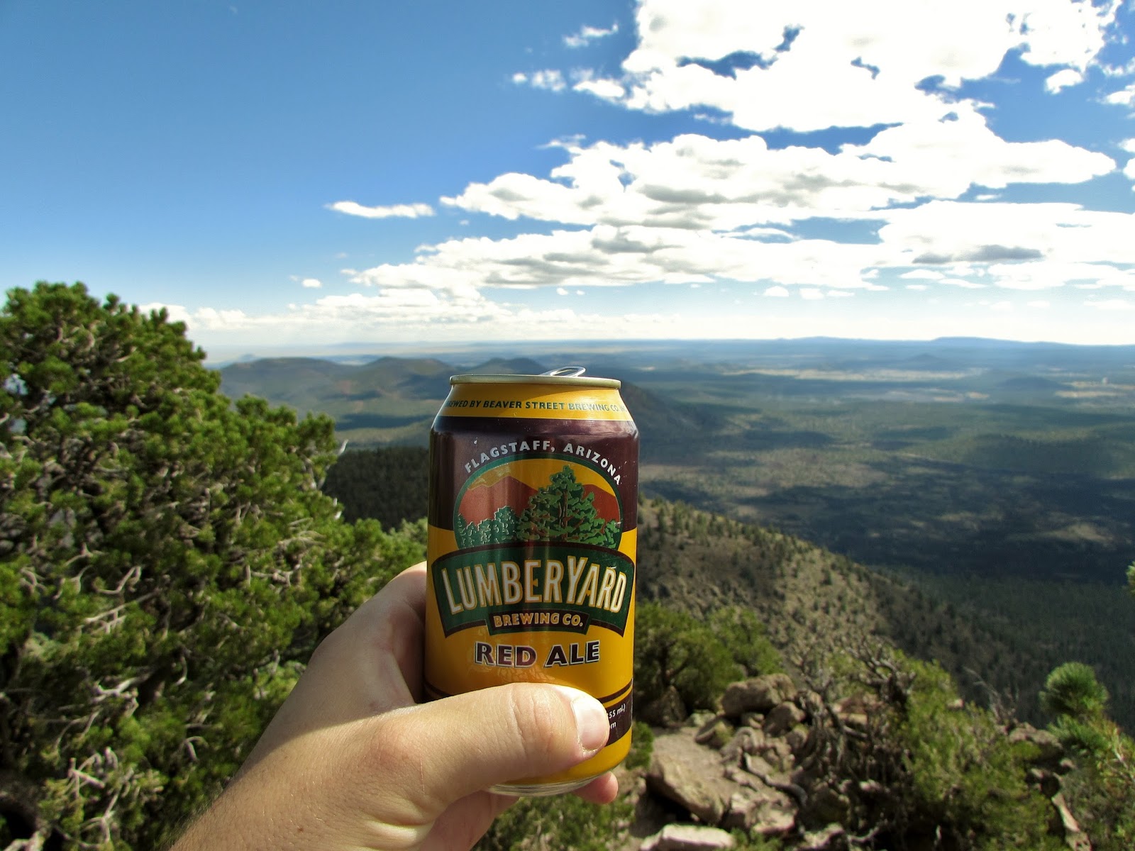
With the sun setting and daylight fading we began our descent down the mountain back the way we came. Hiking the through the golden hour provided beautiful lighting but soon we were hiking through pitch darkness waiting for the full moon to come up. As we hiked through the woods we began to be surrounded by pairs of eyes glowing in the light of our headlamps. After initially being scared at the possibility of black bears and mountain lions and the sound of coyotes out somewhere in the wilderness, we soon realized that the eyes belonged to the herds of cows grazing away on the mountainside. We arrived at the car some 2 hours after beginning our descent, with the last half hour of our hike traveling through darkness. We headed into Flagstaff for dinner at Lumberyard Brewing before making our way around the Kachina Peaks to our campsite at Bonito Campground for the night.
 |
| The beginning of sunset peaking out below the clouds |
 |
| Descending the mountain during the golden hour |
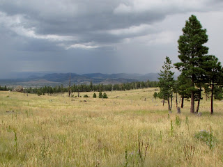
Located just outside Sunset Crater Volcano National Monument, Bonito Campground is one of my favorite campgrounds ever. The campground is dotted with Ponderosa Pine and in the summer features several species of wildflowers. It also has some of the cleanest bathrooms of any campground I've ever seen. We've made a few visits up to the campground this summer, and surprisingly the campground host, Bob, recognized us which made us feel very welcome. We awoke to clear skies overhead and enjoyed breakfast burritos cooked in camp while Stellar's Jays and Abert's Squirrels chattered in the trees overhead. After breakfast we packed up camp and headed to Bonito Park, a huge meadow filled with golds, reds, and purples of the summer wildflower bloom. Prairie Sunflower and Skyrocket were abundant and the views of the Kachina Peaks to the north and Sunset Crater Volcano to the south made for a beautiful panorama.
 |
| Bonito Campground |
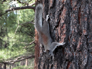 |
| Abert's Squirrel |
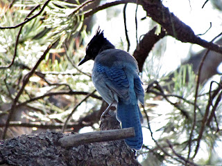 |
| Stellar's Jay |
 |
| Wildflowers in Bonito Park with Sunset Crater Volcano in the background |
 |
| Prairie Sunflower |
 |
| Kachina Peaks in the background with Prairie Sunflower at Bonito Park |
The clear skies quickly faded and storms blew in with lots of rain. Although we had originally hoped for another hike, it became apparent that it would not be any fun and with lightning strikes safety became an issue as well. We instead decided to take a scenic drive through the Coconino National Forest along some of the fire roads around Kachina Peaks. We drove highway 180 to FR 151 and headed north along it through meadows of tall grass and forests full of Quaking Aspen and Ponderosa Pine. The meadows near Hart Prairie were especially beautiful.
 |
| Quaking Aspen along FR 151 |
 |
| FR 151 |
 |
| Lupine along FR 151 near Hart Prairie |
We reached FR 418 and headed east around Kachina Peaks past the Abineau Bear Jaw Trailhead. We spotted a Mule Deer doe and her two fawns and many beautiful wildflowers including Silvery Lupine, MacDougal's Verbena, Butter and Eggs, Hoary Aster, and Hairy Fleabane. We drove past the charred logs of a forest fire with a beautiful view of Kachina Peaks rising to the south. Wildflowers overtook the remnants of the burn and provided a sense of life to the meadow.
 |
| A bee visits MacDougal's Verbena along FR 418 |
 |
| Beautiful Quaking Aspen mixed among Ponderosa Pine |
 |
| Mt. Humphrey's from FR 418 |
 |
| A Mule Deer nursing a fawn |
 |
| A pair of Mule Deer fawns |
 |
| Looking North from FR 418 near the Abineau - Bear Jaw Trailhead |
 |
| A meadow near the Abineau - Bear Jaw Trailhead |
 |
| The remnants of a forest fire north of Kachina Peaks |
As the rain began to pick up arrived back at highway 89 and headed south back into Flagstaff, passing homes surrounded by fields of yellow flowers and talking about how nice it would be to one day retire in Flagstaff. We stopped for some cajun food at Satchmo's and headed back down I-17 towards the heat.
 |
| Homes with a beautiful view along Highway 89 |
The Hike:
Kendrick Trail to Kendrick Peak Lookout Tower, 9.2 miles out and back, 2.600 ft. elevation gain
The Drive: FR 151 Northbound to FR 418 Eastbound to Highway 89
Enjoy the hike and drive and as always leave no trace!