Saturday, September 26, 2015

Bright Angel Trail to Plateau Point

Yesterday I got to head back up to the Grand Canyon, one of my favorite places in the world. My cousin and a few of his friends came out to visit Arizona and they had never been to the Grand Canyon so this was an awesome opportunity to show them a place that means so much to me and get in some training for my upcoming Rim to Rim backpacking trip in October. We hiked Bright Angel Trail down to Plateau Point, a 12 mile round trip trek that descends 3,000 ft. into the canyon to a vista above the Colorado River. I last did this trail back in May so I was excited to be back.

Bright Angel Trail has some very cool history that precedes the formation of the national park. The upper half of the trail was originally created by the Havasupai as a route to access Indian Garden, which was used as a water source. They used the trail until 1903 when they were evicted from the canyon by President Theodore Roosevelt. The trail went on to be acquired by Ralph Cameron, who named it the Bright Angel Trail and charged a toll for hikers wanting to go down into the canyon. Despite the formation of Grand Canyon National Park in 1919, the trail remained privately owned and operated until 1928 when it was acquired by the NPS after a legal dispute. The trail remains one of the most popular places to hike, with many visitors making a day hike down to mile and a half rest house. The trail is also very popular with backpackers to ascend the canyon due to the availability of water at Indian Garden, 3 mile rest house, and mile and a half rest house (water is shut off during colder months at the rest houses to avoid pipe freezing). However, the trail is very steep, maintaining an average of 10% grade from the river to the trailhead and being described as "extremely strenuous" by NPS.

We got up to the canyon just before sunset on Thursday evening and everyone got their first glimpse of the canyon from Mather Point. After dinner at Mather Campground we returned to the rim to watch the stars at Yavapai Point. One of the big expressions at the Grand Canyon is "half the park is after dark" and despite the full moon we were able to see a ton of stars and a few satellites.We started at the trailhead early the next morning, beginning our hike around 7:30. At 6800 ft. the morning temperature was in the low 60s and we were able to get all the way to Indian Garden in the shade. Surrounded by Cottonwood Trees, thick green vegetation, and a small creek, it's easy to forget you are in the middle of the Grand Canyon.


After a short break at Indian Garden, 4.5 miles and 3000 ft. below the rim, we began on the Plateau Point Trail. The trail runs 1.5 miles out to a panoramic view of the inner canyon. Sitting 1,300 ft. above the Colorado River, the view was spectacular. We could see a few rafts moving through the rapids below and hear the rush of the river. Looking across the dry desert landscape of the plateau it was hard to believe that we were up among pine trees only 2.5 hours prior. There was no shade anywhere on the trail so after a quick lunch we headed back towards the rim.


We got back to Indian Garden pretty quickly but once we hit the switchbacks the pace slowed down a bit. Unlike the morning descent, the sun was now completely overhead so it was much hotter. It took an hour to get from Indian Garden to 3 mile rest house. It was also the steepest section of the trail climbing from 3,000 ft. to 4,748 over a mile and a half. The climb to mile and a half rest house was only 1,000 ft. and watching the rim get closer and closer was very motivating. The final climb from mile and a half rest house was 1,100 ft. and I spent a good portion of it stuck behind a mule train that was hauling supplies up from Phantom Ranch. I got out of the canyon around 2:30, 7 hours after our hike began.


The hike: Bright Angel Trail/ Plateau Point Trail to Plateau Point, 12 miles, 3,000 ft. elevation loss

Read more about Bright Angel Trail here:
http://www.nps.gov/grca/planyourvisit/upload/BrightAngelTrail.pdf

Leave No Trace!


Sunday, September 20, 2015

O'Leary Lookout

One of my favorite hikes in the Flagstaff area is the hike up to O'Leary Peak. Located just outside of Sunset Crater Volcano National Monument, the 10 mile round trip hike features 1,900 ft of elevation gain up to panoramic views from the 8,916 ft. summit: Kachina Peaks to the west, Sunset Crater Volcano to the south, the rims of the Grand Canyon to the north, and the Painted Desert to the east. The trail is also conveniently located next to Bonito Campground, my favorite campground in Flagstaff, making it a great day hike to be paired with some exploring through Sunset Crater Volcano/ Wupatki National Monuments for a weekend up in Flagstaff. This was my 3rd time hiking the trail, but it was very special because I got to do the hike with my dad and 3 of his friends who were making their first trip up to Flagstaff.

The trailhead is located in the Coconino National Forest just off FR 545 near the O'Leary Group Campsites, which can be accessed by taking Highway 89 north from Flagstaff towards Page. We got on the trail around 10 AM after making the morning drive up from Phoenix. Unlike some of the other trails in Flagstaff that are more rugged, the trail to O' Leary Lookout is wide and well graded, it's actually a gated roadway that's used by the US Forest Service to haul equipment up to the tower. The first mile or so of the trail is relatively flat, moving through Ponderosa Pine and a few small Quaking Aspens past the northern edge of the Lava Flow from Sunset Crater Volcano. Named for the sunset-like coloration of the volcanic rocks at the top of the cone, the volcano last erupted approximately 1,000 years ago, spreading cinder and volcanic rock for miles around it. 

Sunset Crater Volcano and the Lava Field
Ponderosa Pine
The creation of Sunset Crater Volcano National Monument is actually a pretty interesting story. During the filming of Zane Grey's movie "Avalanche" in 1928, it was planned to detonate explosives on Sunset Crater Volcano to create an avalanche. However, people spoke out against the plan to destroy the volcano and President Herbert Hoover formally created the National Monument in 1930, protecting both the volcano and the lava field surrounding it. It's really cool to see how public concern can play such an important role in conservation. Up until 1973, NPS permitted hiking up to the top of the cone, but closed the trail due to excessive erosion damage which is still visible on parts of the volcano today. Being just north of the volcano, O' Leary Peak offers visitors the opportunity to see the volcano from a distance without damaging it.

Looking south from the trail at the first switchback


Rabbitbrush and Common Mullein blooming with Kachina Peaks in the background
Halfway to the top
Kachina Peaks
Looking South
One of my favorite things about the trail is the amount of wildflowers that can be seen along it. Lupines, Skyrocket, Common Mullein, Rabbitbrush, and many others are seen all along the trail, with some of the most beautiful displays sitting right at the edges of switchbacks with Kachina Peaks as a backdrop. The peak time of year to see these flowers is July-September. Wildlife viewing is also very good. Abert's Squirrels, Stellars Jays, Ravens, Horned Lizards, and Western Tanagers can be commonly seen among the pines.

Lupine
Sunset Crater Beardtongue, native only to Sunset Crater
Skyrocket
A bee visiting Rabbitbrush
A wasp on an aster
A very small Horned Lizard
As we followed the trail up towards the top the views got better and better. First, a slight increase of elevation showed the expanse of the lava flow. After another set of switchbacks, the Kachina Peaks became visible. The final 1,000 ft. of the trail after the switchbacks is a very steep trek, but the rewarding view from the top is unbelievable. During the summer months, there is a very friendly fire lookout working in the tower and she has so much knowledge about the area. We spent a good half hour at the top enjoying the scenic view, looking down into Sunset Crater Volcano, and drinking our summit beers, Lumberyard's Red Ale (brewed in Flagstaff).We descended the mountain back the way we came and headed back into Flagstaff before making our way back to the valley.
O' Leary Lookout
Summit Beer: Lumberyard Red Ale
Kachina Peaks seen from the summit of O' Leary Peak
Sunset Crater Volcano seen from the summit of O' Leary Peak
The Hike:
O' Leary Trail, 10 miles roundtrip, 1,900 ft. elevation gain

Read more about Sunset Crater Volcano National Monument here:
http://www.nps.gov/sucr/index.htm

Leave No Trace!

Friday, September 18, 2015

Birds! Big Year World Record Today!

Humans are competitive. We gauge our success in life by comparing ourselves to others around us. We live and die with our beloved sports teams, sinking billions of dollars and hours of our days into watching competition. Competition captivates us in the strangest and most entertaining of places: The Nathan's Famous Hot Dog Eating Contest on the 4th of July, lumberjack competitions on The Great Outdoor Games, The Air Guitar World Championships, and Redbull Flugtag. However,  the most unique competition I have ever heard of is the Big Year, a competition among birdwatchers every year to see the most number of species between January 1st and December 31st of a given year.

Turkey Vulture in the Tonto National Forest, AZ
I was first introduced to the Big Year in 2011 when I saw the film "The Big Year". Based on Mark Obamscik's book "The Big Year: a Tale of Man, Nature, and Fowl Obsession", the film stars Jack Black, Steve Martin, and Owen Wilson. It follows 3 birders who embark on a big year, competing to see the most species of birds in North America. While it was a huge flop in the box office, I thought it was an outstanding movie and I really enjoyed it. Photographing and identifying plants and animals is one of my favorite things to do while hiking so it really struck a chord with me. However, it made me wonder "what kind of person takes a year off their life to go look at birds?! This is the craziest thing I've ever heard of."

Pyrrhuloxia in Saguaro National Park, AZ
Apparently alot of people. In fact, the first Big Year on record was done in 1939 by a businessman named Guy Emerson, who would use his business trips at peak birdwatching seasons to see 497 species of birds in North America. Big Years have expanded to include international, national, state-wide, and regional competitions. 1998, the year that the current record of 745 birds spotted within the American Birding Association's boundaries (North America north of Mexico essentially), became the subject of Obamscik's book and subsequent 2011 film.

Western Tanager in Prescott National Forest, AZ
After following the Audubon Society on Twitter, I began to follow the efforts of Noah Strycker, an Oregon based birder who has been spending 2015 attempting to see 5,000 species of birds around the world. Audubon Society would retweet his tweets about his Big Year and I found myself suddenly rooting for a complete stranger in an informal competition to see birds. Today (day 259), with over 3 months left in his Big Year, Noah saw his 4,342nd bird species, a pair of Sri Lankan Frogmouths. At his current pace he is more than likely going to reach his 5,000 species goal.
Sandhill Cranes in Glacial Park, IL
While I won't be breaking any Big Year records anytime soon, it's pretty cool to see someone care so much about the environment and the beautiful birds that we have in the world. Hopefully Noah's efforts raise awareness among us about the importance of conservation and the wonders of nature.

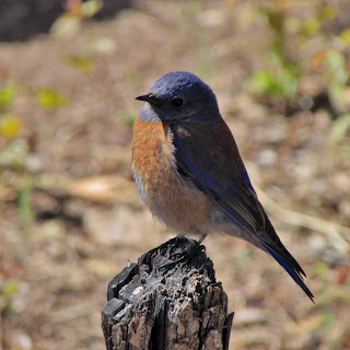
Western Bluebird in Grand Canyon National Park, AZ
Northern Cardinal in Algonquin, IL