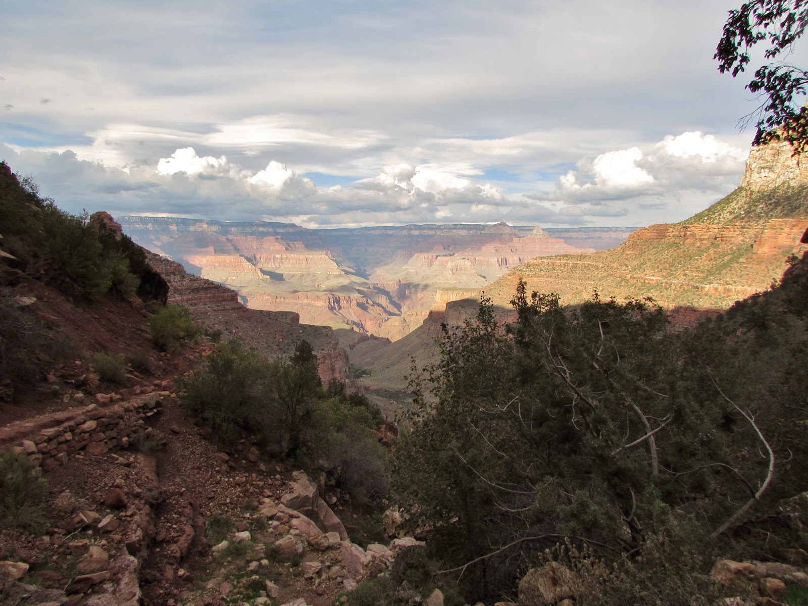
Finally! After almost 2 years of waiting and multiple attempts at obtaining a permit, we were able to cross off a lifelong bucket list item and backpack across the Grand Canyon rim to rim. In August 2013 my dad, a few friends, and I hiked down the South Kaibab Trail and spent the night at the bottom of the canyon in Bright Angel Campground. The next day we ascended via the Bright Angel Trail and along the way met many people who were making the trek all the way from the North Rim back up to the South Rim, a 23.5 mile hike with about a mile in elevation change. After 3 attempts at getting a permit, we were finally granted one for this October and could not have been more excited to get on the trail. We would be splitting the hike up into 3 days: a shuttle ride to the north rim and hike down the North Kaibab Trail to Cottonwood Campground on Saturday, a hike along the North Kaibab Trail from Cottonwood to Bright Angel Campground with a few short dayhikes on Sunday, and finally a climb out of the canyon via Bright Angel Trail on Monday.
Our team was set to include my dad, my sister, my friend Jeff from grad school, our friend Eric who joined us on our trip to Zion and Bryce Canyon last year, and our friend Abby who backpacked in Sequoia with us earlier this summer. Only 2 weeks before the trip a bad omen happened, Eric was involved in a bicycle accident that broke his collarbone (thankfully he is recovering!) and was unable to join us. In the days leading up to the hike, the forecast looked absolutely dismal. 90% chance of rain and thunderstorms on Saturday with 70% chance of rain and thunderstorms on Sunday and Monday. Everyone began to arrive in Arizona to start the hike and we headed up to the canyon on Friday night, but the forecast remained the same. Storms on Friday night resulted in us spending the night in Maswik Lodge, and as we finalized packing we began to debate our trip. Were we nuts to try to hike in this bad weather? what would we do if we were unable to go? was Eric's injury and the bad forecast an omen to stay out of the canyon? We decided that we would talk to the shuttle company and see if we could get a ride back from the North Rim if the weather looked dangerous.
Saturday morning came and forecast remained pretty bleak. We walked over to Bright Angel Lodge to catch the Trans Canyon Shuttle. There were many people there planning on heading out and when the shuttle driver told us we could easily get a ride back, we decided we had to go for it. The shuttle departed at 8 AM and took us up through Marble Canyon through some of Arizona's most beautiful landscapes. We shared our van with a group from Rancho Cucamonga, CA, 5 experienced backpackers who's company made the 4 and a half hour shuttle ride extremely enjoyable. We spent the time talking about all of the cool outdoors trips we had taken and listening to our driver tell stories about his experiences with the Grand Canyon. He had come to the area in 1974 as a student worker for the summer and fallen in love with the canyon, deciding to stay permanently.
 |
| Our packs waiting for the shuttle, we brought Eric along in spirit for our trek |
 |
| The Trans Canyon Shuttle |
 |
| Marble Canyon |
As we entered the north rim of Grand Canyon National Park, we were so surprised by how different the landscape was from the south. We passed the remnants of the warm fire, a forest fire that burned over 50,000 acres in 2006. Along the roadway in we saw signs warning of bison crossing, and although we were unable to see any of them, a heard of these hybrid "beefalo" have been roaming the meadows along the north rim since the early 1900s as the result of an abandoned bison breeding experiment. We were dropped off at the trailhead of the North Kaibab Trail just after noon and wasted no time getting on the trail. The forecast called for a thunderstorm by 3 PM and we had a long way to go. Our plan for the day was to get down to our campsite at Cottonwood Campground, 6.8 miles and 4,161 feet below the trailhead.
The hike started with a 1.7 mile section from the trailhead (elevation 8,241) to Supai Tunnel. This stretch of trail was pretty steep, with 1,441 feet in elevation loss but was extremely beautiful as we hiked among the fall colors. The reds and yellows of changing leaves scattered among the evergreens made the trail even more colorful. We stopped for some photos at Coconino Overlook, which provided dramatic views of Roaring Springs Canyon that we would be descending on our way to Cottonwood. We reached Supai tunnel in just over an hour, watching clouds slowly drift up from the south rim.
 |
| North Kaibab Trail just below the trailhead |
 |
| Quaking Aspens providing fall foliage |
 |
| View from Coconino Overlook |
 |
| North Kaibab Trail |
 |
| Fall colors along North Kaibab Trail |
 |
| Water and restrooms at Supai Tunnel |
 |
| Supai Tunnel |
As we passed through Supai Tunnel, the trail became much steeper. Several steep switchbacks crossed back and forth, dropping elevation very quickly. The trail also became very narrow, carved into the rock walls with steep dropoffs on the outside of the trail. The section of trail between Supai Tunnel and Roaring Springs was 3 miles with 1,580 feet of elevation change. Roaring Springs, the source of Grand Canyon National Park's water supply, provides the park with 500,000 gallons of water per day piped down through Bright Angel Canyon to Phantom Ranch and then across the Colorado River on the Silver Bridge where it is pumped up to the south rim.
 |
| North Kaibab Trail below Supai Tunnel |
 |
| North Kaibab Trail below Supai Tunnel |
 |
| The trail became much narrower below Supai Tunnel |
 |
| Jeff remaining calm as the storm sets in |
 |
| Footbridge below Supai Tunnel |
 |
| Abby crossing the footbridge |
 |
| We dubbed Laura "the blueberry" when she put on her poncho |
Just over a half mile from Roaring Springs we heard the first cracks of thunder from the coming storm. The rain began to come down very heavily and there was quite a bit of lightning. If there's one thing I am terrified of when I'm outdoors it's lightning and for the duration of the storm I was not the most fun person to be around (I owe the people I was hiking with an apology, sorry guys). We had lightning strikes within 2 miles of our group (calculated by counting the number of seconds between lightning flash and thunder and dividing by 5), which is well within the striking distance of a lightning bolt so I was pretty terrified and tense. I felt pretty lucky to be hiking with Jeff, Abby, and Laura who were so much calmer in the storm and we pushed through safely.
 |
| Approaching Roaring Springs on the North Kaibab Trail |
We wound up passing Roaring Springs to go an extra 0.7 miles to the
Manzanita Rest Area (formerly the Pumphouse Ranger Station) adding
another 620 feet of elevation loss along the way. We rested for 20
minutes or so allowing us to catch our breath as the storm died down. From Manzanita Rest Area to Cottonwood Campground it was only an additional 1.4 miles over a mild 520 foot elevation loss and we arrived at camp without any further issues from the weather. As we cooked dinner (Backpacker's Pantry cuban coconut beans and rice, which was awesome) we saw rim to rim to rim runners passing through camp for their final ascent up to the north rim. These people had started early in the morning and run 23.5 miles across the canyon, turned around and were headed right back. It was pretty humbling to see people achieving something so incredible. We headed to bed early, but not before the clouds parted to show us the milky way floating overhead.
 |
| Resting at Manzanita Rest Area |
 |
| Bright Angel Creek near Manzanita Rest Area |
 |
| Approaching Cottonwood Campground on the North Kaibab Trail |
We woke up early on Sunday morning to clear skies and perfect temperatures. While Cottonwood Campground was a beautiful place to spend the night, the bathroom situation was not so great, and we suffered through visits to one of the worst smelling (the ammonia actually made my eyes burn) outhouses I've ever experienced before heading out on the trail for our second day of hiking.
 |
| Our campsite at Cottonwood Campground |
 |
| Heading South from Cottonwood Campground |
Our plan for the day was to hike 7.2 miles from Cottonwood Campground to Bright Angel Campground, losing an additional 1,600 feet of elevation along the way. We would be taking a break 1.6 miles below Cottonwood to do a side hike out to Ribbon Falls. The trail between Cottonwood and Ribbon Falls was beautiful as we moved along the riparian areas of Bright Angel Creek under blue skies. The side trail to Ribbon falls only took about 20 minutes but it was one of the most beautiful places along the trail. The area was dense with vegetation and we felt as if we were hiking through a jungle.
 |
| Small waterfall alongside Ribbon Falls |
 |
| Ribbon Falls |
 |
| Ribbon Falls |
 |
| Inside the cave at Ribbon Falls |
 |
| Mint growing among the vegetation at Ribbon Falls |
As we arrived back at the trail, we bumped into our friends from California and began to head towards Bright Angel Campground, 5.6 miles ahead. The stretch from Ribbon Falls to Bright Angel Campground was my absolute favorite part of the whole hike. As we followed Bright Angel Creek we were surrounded by the canyon's wide towering walls. The contrast of the riparian habitat right among the cactus and shrubs of the desert showed just how varied the Grand Canyon's ecosystems can be, even right within your own line of sight.
 |
| North Kaibab Trail at junction with Ribbon Falls |
 |
| North Kaibab Trail below Ribbon Falls |
 |
| Headed south along North Kaibab Trail |
 |
| Headed south along North Kaibab Trail |
 |
| A view of the canyon walls along North Kaibab Trail |
 |
| Headed south along North Kaibab Trail |
 |
| Looking north at the wide section of canyon before entering the box |
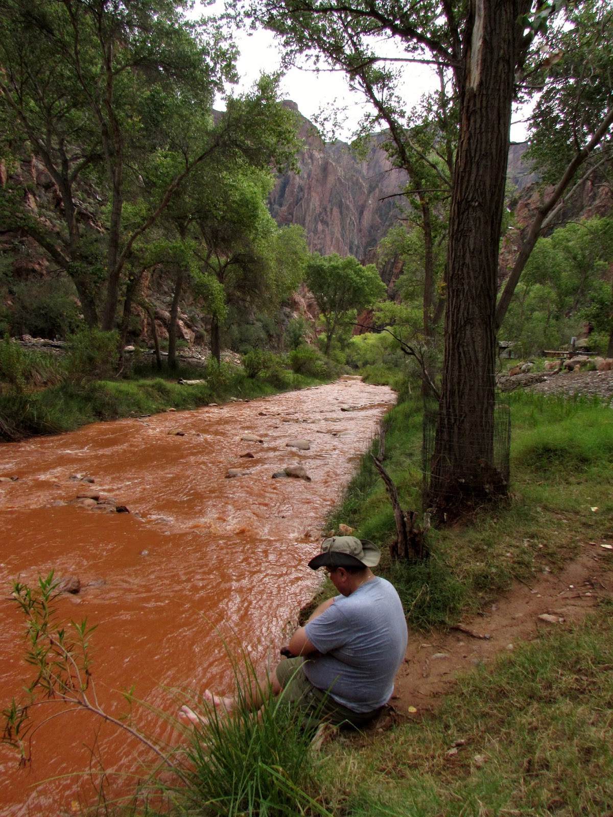
We crossed a series of footbridges and entered a section of the trail known as "the box", an area where the canyon becomes much narrower and the trail hugs Bright Angel Creek much tighter. As we moved through the box we began to get passed by rim to rim to rim runners who had already descended from the south rim nearly 13 miles away. We wound through the narrow walls of the box passing the junction of Bright Angel Creek with Phantom Creek, both of which were a shade of orange-red, stained from the heavy sediment load washed into them by the previous day's storm. After 2 more footbridges, we exited the box and made our way into Phantom Ranch.
 |
| North Kaibab Trail hugging the canyon walls |
 |
| Entering "the box" |
 |
| Bright Angel Creek and North Kaibab Trail between the narrow canyon walls |
 |
| Caterpillar chowing down on some Sacred Datura |
 |
| The box |
 |
| Phantom Creek flowing into Bright Angel Creek |
 |
| Crossing one of the footbridges in the box |
We arrived at Phantom Ranch at noon, some 5 hours after our hike began in the morning. Phantom Ranch is known for its lodge, dining hall, and ranger station, which allows tourists some backcountry luxuries including cold beer and lemonade, a steak dinner, flush toilets, and sleeping indoors in stone cabins. Many people who aren't able to or interested in hiking down choose to ride mules down to Phantom Ranch to stay the night below the rim. As we passed through Phantom Ranch on the way to the adjacent Bright Angel Campground, we stopped at Phantom Ranch Canteen for some cold lemonades and candy bars. After setting up camp, we cooled our feet off in Bright Angel Creek while we enjoyed our lunch.
 |
| Cottonwoods along Bright Angel Creek as the trail approaches Phantom Ranch |
 |
| Monarch Butterfly |
 |
| Phantom Ranch Canteen: cold beer here. |
 |
| Bright Angel Creek flowing through Bright Angel Campground |
 |
| Cooling our feet in Bright Angel Creek |
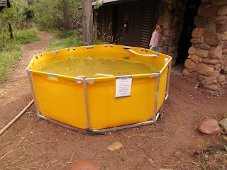 |
| Due to a waterline break, visitors had to fill buckets from these tanks and pour them into toilets to flush. |
With our camp already set up for the night so early in the afternoon, Jeff and I decided to do a short 1.7 mile loop that uses the River Trail, silver bridge, and black bridge to see the Colorado River. We crossed the silver bridge, which carries the park's water supply via the trans canyon pipeline below. Completed in the 1960s, the silver bridge is usable by hikers only. Once we reached the south shore of the Colorado River we moved east along the River Trail towards the South Kaibab Trail. Along the way Jeff, a trained geologist, pointed out a variety of minerals and rock formations, explaining their formation and geologic significance. We reached the South Kaibab Trail and after passing through a rock tunnel, crossed the Colorado River on the Black Bridge. The bridge was built in 1928 and is used by hikers and mules to reach Bright Angel Campground and Phantom Ranch. We got back into camp in time to dodge an afternoon thunderstorm.
 |
| Silver Bridge |
 |
| The Trans Canyon Pipeline below Silver Bridge |
 |
| Zoroaster Temple towering above the Colorado River seen from the River Trail |
 |
| Where Bright Angel Creek meets the Colorado River |
 |
| Copper Ore resting in the walls of the canyon along the River Trail |
 |
| Jeff along the River Trail |
 |
| Black Bridge |
 |
| Looking through the tunnel at Black Bridge |
 |
| The River Trail |
After waiting out a brief afternoon thunderstorm we headed back into Phantom Ranch Canteen for a cold beer and a ranger-led talk that described the formation of the Grand Canyon and its history using an analogy of a calendar year. It was very interesting to learn that John Wesley Powell's first expedition into the Grand Canyon didn't even occur until 11:59 PM on December 31st in the analogy, making us realize the scale of time in the formation of the beautiful landscape we were hiking through. After another dinner of Backpacker's Pantry, this time curry and Jamaican jerk chicken, we went to bed under a canopy of stars.
 |
| Campsite at Bright Angel Campground |
 |
| Dinner |
Our final day of hiking was going to be our most difficult day as well. We would be ascending the canyon via the Bright Angel Trail, a climb of 4,380 feet over 9.5 miles. We woke up before sunrise and headed out on the trail around 6:30 AM just as the sun was poking over Zoroaster Temple. We crossed the Silver Bridge and hiked along the Colorado River for 1.5 miles to the River Resthouse. As the trail wound along the river it moved up and down the cliffs, but frustratingly resulted in 0 net elevation gain. We stopped at River Resthouse for 15 minutes to wait for Jeff, Laura, and Abby to catch up to us and enjoyed the scenery at Pipe Creek Beach in the meantime.
 |
| Crossing the Silver Bridge |
 |
| Catching Sunrise from the south side of the Colorado River |
 |
| Following The River Trail towards Bright Angel Trail along the Colorado River |
 |
| The first rays of sunlight hitting the inner canyon |
 |
| The Colorado River seen from Bright Angel Trail |
 |
| Approaching River Resthouse |
 |
| Pipe Creek Beach |
After our short stop at River Resthouse we began an intense climb to Indian Garden Campground, a 3.2 mile hike up numerous switchbacks that resulted in a 1,320 foot elevation gain. Along the way we followed Pipe Creek and as we hit the switchbacks Laura, Abby, and Jeff set out ahead of my dad and me. It took us a few hours to move up the switchbacks and as we began to enter Indian Garden I could see that my dad was struggling pretty hard. During our trip to Zion last fall he climbed Angel's Landing with a torn meniscus and despite having surgery to fix his knee, 2 days and 19 miles of hiking were finally taking their toll on his knees.
 |
| Laura hiking up Bright Angel Trail |
 |
| Rock Squirrel |
 |
| Bright Angel Trail |
 |
| Moving up the switchbacks towards Indian Garden |
 |
| Approaching Indian Garden |
 |
| Approaching Indian Garden |
 |
| Approaching Indian Garden |
 |
| Looking back at Zoroaster Temple |
As we got into Indian Garden, it was clear that my dad was not going to make it any further on his knee in the condition it was in. I set him aside at some picnic tables in the shade of the many cottonwood trees and headed to the ranger station to weigh our options. The ranger was incredibly helpful, giving us icepacks for his knee and some electrolyte supplement for his water to give him a boost of energy. We spent 2 hours at Indian Garden resting and rehydrating. While she offered us the option to stay the night to rest dad's knee, we (stubborn Polaks) decided to push on out of the canyon as far as we could make it. We still had 4.9 miles and 3,060 feet to go but were determined to finish what we started.
 |
| Entering Indian Garden |
 |
| Indian Garden |
 |
| The trail was relatively flat before hitting the switchbacks as we left Indian Garden |
The climb to 3 Mile Resthouse was 1.7 miles with a brutal 948 foot climb. Known as Jacob's Ladder, the section of trail took us just over 2 hours, which was pretty impressive given the fact that my dad was doing it on a wounded knee and I was giving him some help with his pack. At the resthouse we met some wonderful people who were very encouraging and looking down at Indian Garden below we got a second wind and began our climb towards Mile and a Half Resthouse. As we left 3 Mile Resthouse, dark clouds began to blow in and soon we found ourselves underneath booming thunder and flashes of lightning. We dropped our packs and crouched along the trail, nervously watching lightning hit some of the cliffs out in the canyon. The storm only lasted a few minutes and as the clouds moved away a beautiful rainbow appeared.
 |
| 3 Mile Resthouse |
 |
| The storm after it had passed over us |
 |
| A rainbow appeared after the storm |
We finished our climb up to Mile and a Half Resthouse under clear skies. We had climbed another 981 feet from 3 Mile Resthouse and knocked off another 1.5 miles. As we sat in the final resthouse and refilled our water, we were only 1.6 miles and 1,131 feet from reaching our goal.
 |
| Approaching Mile and a Half Resthouse |
 |
| Mile and a Half Resthouse |
 |
| Mule Deer along the trail |
We continued our hike from Mile and a Half Resthouse as the sun began to set. My dad's knee was holding up and we began to plan dinner at the restaurant in Bright Angel Lodge while we hiked. I couldn't wait for the burger waiting for me at the top. As we got within a mile of the trailhead another storm blew in but it was very clear to us that this would not be one to end quickly. As thunder roared overhead and flashes of lightning illuminated the sky we passed through the two rock tunnels along the trail, finally reaching the trailhead and successfully completing our rim to rim hike.
 |
| Sunset from the Bright Angel Trail right before the final storm blew in |
 |
| The doors to Bright Angel Lodge, 3 days later |
We met Laura and Abby at the top and enjoyed a fantastic meal at Bright Angel Lodge while making our "we're alive!" phone calls to friends and family. I couldn't be prouder of my dad, my sister, Abby, and Jeff for completing the rim to rim hike and I can't wait for the next opportunity to do it again. My dad set out to do this hike years ago and finished strongly despite his knee injury. It was such an inspiring trip and I feel so lucky to have gotten the opportunity to do it with the awesome group of people that we had. The Grand Canyon is such an amazing place and the memories we made on this hike will last a lifetime.
The hike: Rim to Rim via the North Kaibab Trail and Bright Angel Trail, 23.5 miles, 5,761 foot elevation loss + 4,380 foot elevation gain.
For more info on backpacking the Grand Canyon visit the website here:
http://www.nps.gov/grca/planyourvisit/backcountry.htm
Leave No Trace!